
The Hawaii Tax Map Key, also referred to as TMK, is a unique identification system used in the state of Hawaii to identify and locate properties. It is a combination of numbers that are assigned to each parcel of land in the state, and is used by government agencies, real estate professionals, and private individuals to identify and locate properties.
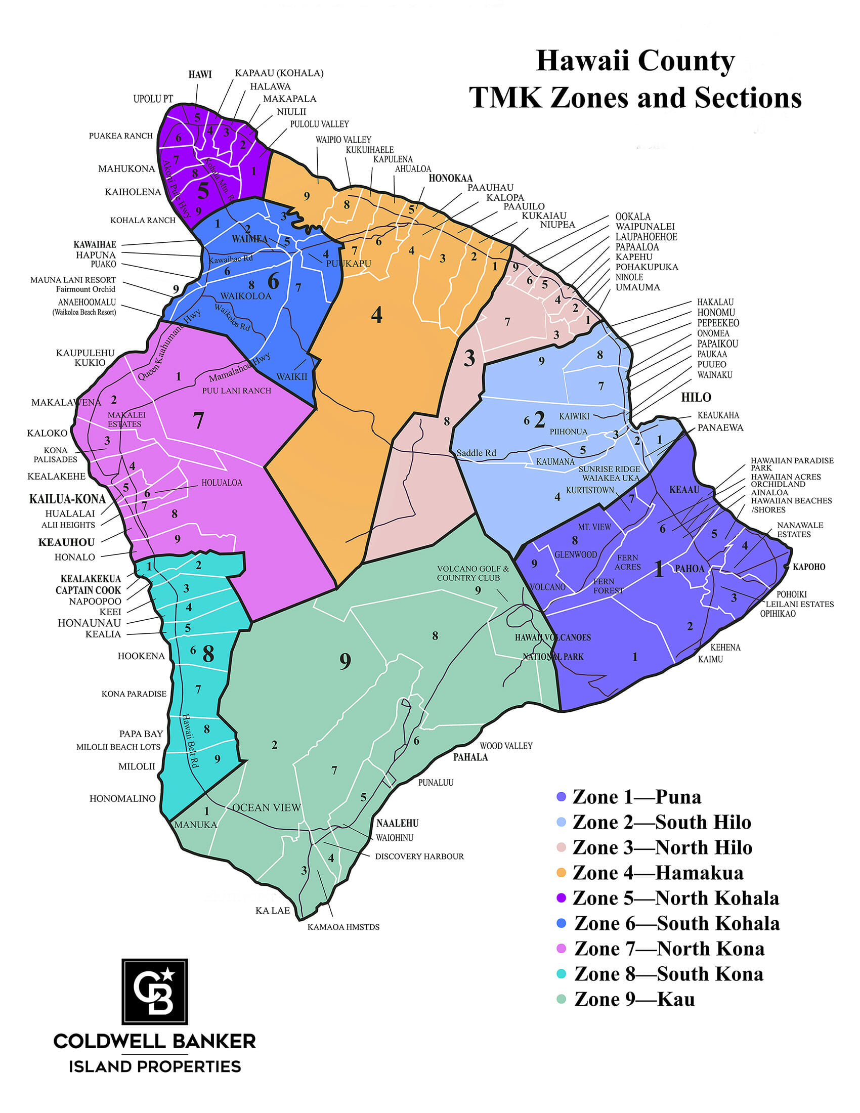
The Hawaii TMK system is based on a hierarchical system, with the first numbers indicating the island on which the property is located, followed by numbers that indicate the specific district and area within the island. The last numbers and letters indicate the specific parcel of land within the district and area.
Here is a breakdown of a typical 9-digit TMK formatted I-Z-PPP-ppp:
Islands are identified in the following manner:
For example, a TMK of “3-6-8-28-001” would indicate that the property is located on Hawaii Island, in the South Kohala area (zone 6) of Waikoloa Village (section 8), and is specifically located in the Sunset Ridge neighborhood’s (plat 28) first parcel (parcel 1).
It is important to note that Hawaii TMK is not the same as a property’s street address. TMK is a unique identification number assigned to a property, while the street address is the physical location of the property.
One of the key benefits of the Hawaii TMK system is that it allows for easy and accurate identification of properties. It also helps to streamline many property-related transactions, such as property tax assessments, land sales, and mortgage loans. Anyone who is buying, selling, or working with properties in Hawaii should have a good understanding of the Hawaii TMK system.
Coldwell Banker Island Properties
75-5799 Alii Drive A3, Kailua-Kona, HI 96740
Copyright © 2023 Waikoloa Properties & Lifestyle. Information presented deemed reliable but not guaranteed.
Please enter your username or email address. You will receive a link to create a new password via email.
Call or Text Me for Expert Real Estate Advice!
